Land & Development
Development Opportunity
Prime location to rezone from current residential low density (R-L) to residential medium density (R-M), residential high density (R-H) or mixed use residential (MU-R) zoning.
Previous like-type and size residential medium-to-high density developments have yielded 10-15 units per acre while previous like-type mixed use residential (MU-R) have yielded up to 35 units per acre.
There is endless potential to create a captivating development at the entrance of Old Town Louisville that generates a strong business opportunity while simultaneously serves the needs of the community.
Prime 2.38 Acres For Sale
Address: 1655 Main St, Louisville, CO 80027
Legal Description: 2.5 AC OF N ½ NE ¼ LESS TRS 1682 & 1999 8-1S-69
Account Number: R0030767
Parcel Number: 157508100004
Total Acreage: 2.388 Acres (104,058 Sq. Ft.)
2024 Taxes: $28,7556
Current Zoning: R-L (Residential Low Density)
Asking Price: $3,995,000

Tremendous Potential
The map below is for illustrative purposes only and does not represent an approved City of Louisville plan. The sample site concept simply outlines the following elements, which were created to maximize the development potential while also addressing needs that are based on feedback from the City of Louisville.*
Sample Site Plan
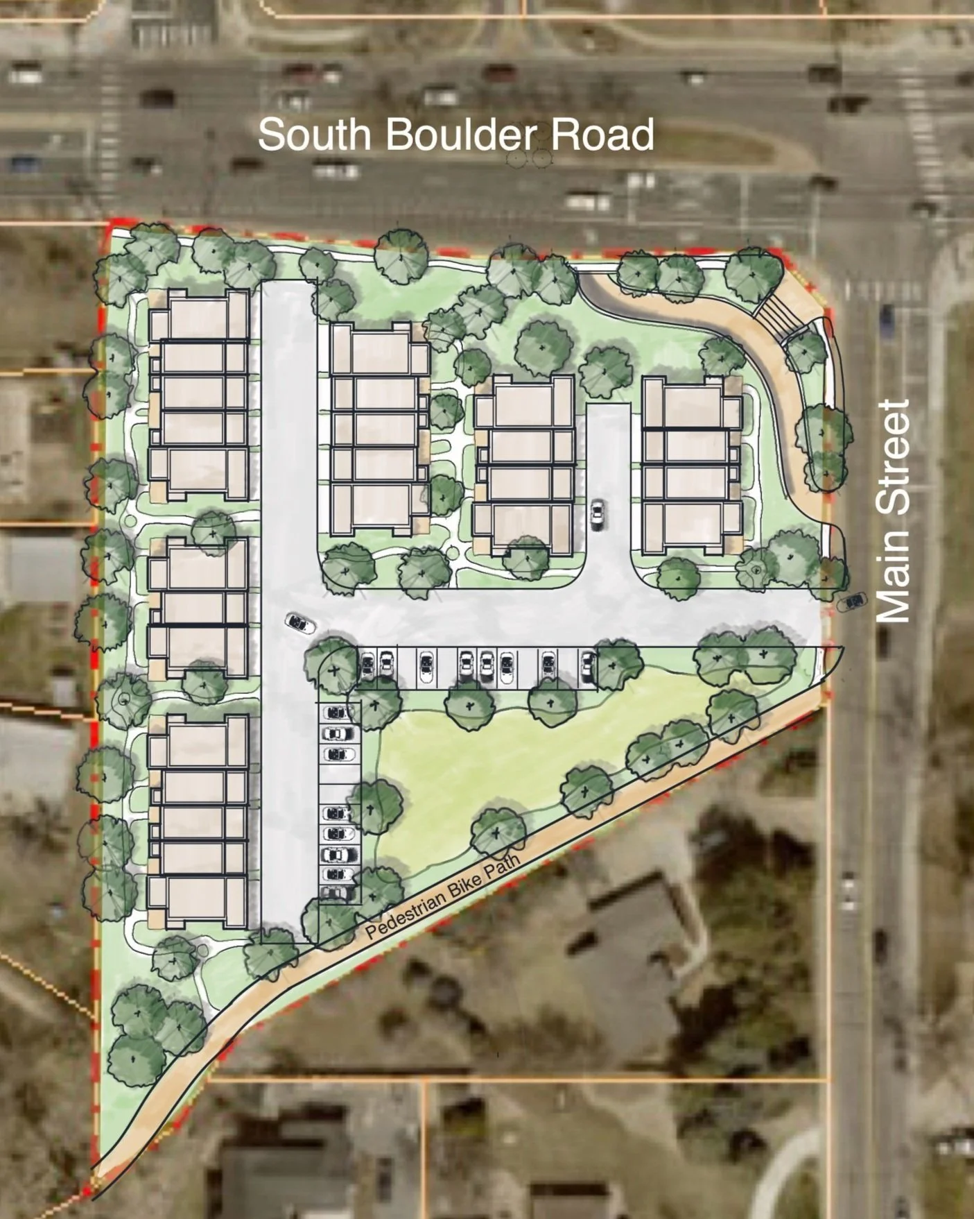
Dwelling Units & Parking
6 Buildings with an assortment of 1-Bedroom and 2-Bedroom units (maximum height of the buildings is 40 ft)
12 Two Bedrooms units with attached 2-Car Garages. All 2-Bedroom units are located on the ends of the buildings.
14 One Bedroom units with attached 1-Car Garages. All 1-Bedroom units are located on the interior of each building.
Vehicle access from the southernmost point of the east side of the site on Main Street
22 Dedicated onsite Parking Spaces
Drainage, Detention, and Water Quality
The sample site plan allocates a large portion of the southern portion of the parcel between the vehicle driveway and proposed pedestrian path as an area that could satisfy water drainage and detention as well as satisfy additional land dedication requirements.
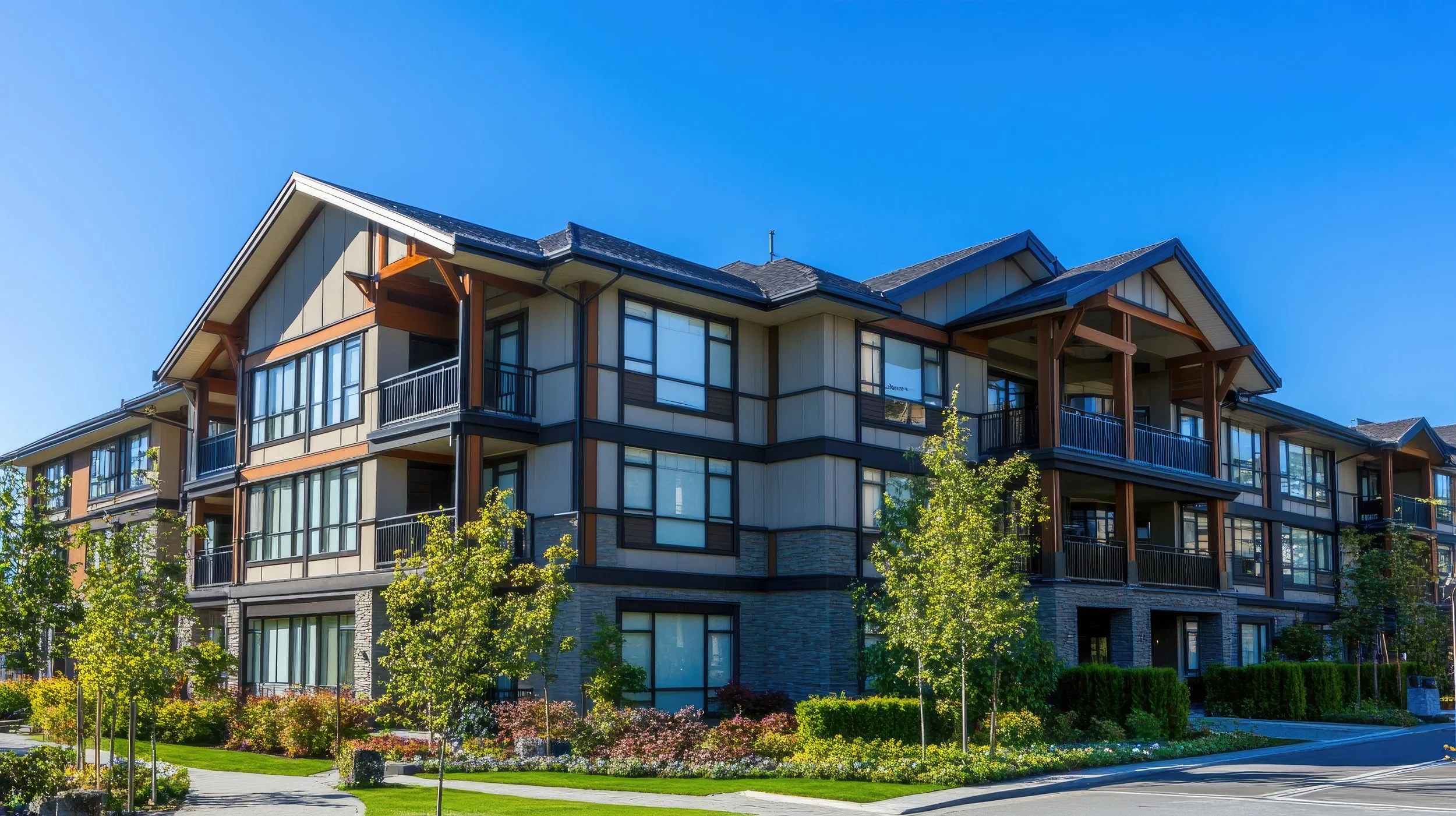
Inspirational Images


Public Land Dedication
A minimum of 15% of the land needs to be dedicated for a park, school, or other public purposes as determined by City Council. The sample site plan attempts to satisfy these requirements through the following:
Creation of a new pedestrian walking / bike path that crisscrosses the northeastern boundary of the property to accommodate off-street traffic flow from proposed underpass under South Boulder Road to the sidewalk on Main Street.
Creation of a new pedestrian walking / bike path along the southern boundary of the parcel to connect main street + the South Boulder Road underpass to the west side of Louisville Middle School as well as the neighboring streets and parks. This new pedestrian / bike path would be created by burying and covering the existing Miller Lateral of the New South Boulder and Rock Creek Ditch.
*Requires rezoning and approval by City Council